Saturday, November 10, 2012

"The A-B-C's of Biking" (and you won't believe the "C")

November 10, 2012  PEDALS adventure: 

When we started this season of biking, we certainly did not expect it to last into November, but when November brought some unseasonably warm weather (relatively speaking), we quickly responded by loading up the bikes, putting on a few layers and setting out for a new biking adventure.  It became clear that this was to be “The A-B-C’s of Biking” adventure.

Susie, school secretary extraordinaire and fellow bike path enthusiast, has been raving about the Pumpkinvine Trail that goes right through the heart of Indiana Amish country, between Middlebury and Shipshewana.  Not too long, not too far away, and not too hilly was her report and it sounded good to us….plus, she said we could look for a very unusual animal on a particular farm along the path (that piqued my curiosity) …but more on that later.

We decided to start in Middlebury, and easily found the Pumpkinvine Trail  right behind the local Dairy Queen, just like Susie said.  We put on our layers, and our gloves and set out.   The path immediately is flanked by farms on each side (mostly Amish) , and many riders were coming towards Middlebury---and the Dairy Queen ---as it appeared to be a favorite Saturday activity of the local Amish families. 
A is for Amish--farms, harvesting and a school
We enjoyed farmland, which was easily seen because the leaves had fallen from the trees, exposing the beautiful scenery.   It was easy to negotiate the several country roads that crossed the Pumpkinvine Trail as many of farms belonged to the Amish, resulting in fewer than usual cars on the backroads. Although is seemed a bit late, there was still harvesting going on in the fields by the Amish farmers, driving their horses as they pulled the harvesting equipment.  Yes, “A is for Amish”  in our  A-B-C ride which also became clear when we came upon an Amish School.
Amish schools are common, and as they are not very large, many are needed to serve the Amish community…not mention that bussing students from all across the rural area is not an option.  All that I have seen are white, tidy, and always seem to have a nice playground area too, something that I, as an elementary teacher, always notice.  
B is for Bike Parking on a crowded shopping day 
We continued on to Shipshe, where I promised Tom a wonderful lunch at The Blue Gate Restaurant, a Shipshe favorite of ours…and hundreds of other tourists!  The Pumpkinvine Trail takes a slight jog and travels on the surface roads into Shipshe.  As we approached, it became clear that the tourists were out in force, cars were bumper to bumper, and the sidewalks were filled with people.   We learned that it was their pre-Christmas festival weekend, complete with a Light Parade scheduled for 6 PM.  Normally, this is the type of weekend we would avoid because of the crowds, and we certainly has some challenges avoiding cars and people as manuervered around town.  However, being located in Amish Country, bike racks are easily found in Shipshe, which led Tom to comment that we had a much easier time finding a place “to park” compared to everyone circling around in their cars..the “B is for Bike parking” in our A-B-C ride !!!  A fabulous lunner or lupper (lunch/dinner/supper) Amish inspired food (noodles, roast beef, fresh bread, apple butter, sweet potato casserole) and we were ready for the 10 mile trek back….I was glad for my gloves and sweatshirt.
The Historical Marker for
Chief Shipshewana
As we approached Shipshe, we noticed a historical marker which we decided to visit on our way back to Middlebury.  Turns out it was a marker to Chief Shipshewana (who knew Shipshe was named after a person?) of the Pottawattamie Indians who was allowed to return to die at Shipshewana Lake (who knew there was a lake in Shipshe?) in 1835.  Curiously, Chief Shipshewana’s name means “vision of a lion.”  Now, I may not know all the ins and outs, but how does an Indian, in the early 1800’s , in the center of the  United States, come  to have a name that references an animal that is indigenous to central Africa?   Enquiring minds (like mine) want to know!

But, what about the “C” in our A-B-C trip?  Along the Pumpkinvine Trail, halfway between Middlebury and Shipshewana, you can find an Indiana farm that is raising CAMELS!   Yes, as hard as it is to believe, camels are being raised just off the Pumpkinvine Trail.   Susie, my source for all things Pumpkinvine, gave me the heads up to watch for them and we weren’t disappointed.   There they were, calmly grazing in a couple of large pens, oblivious to the fact this wasn’t Egypt nor a Christmas Pageant (the most likely place you could see a live camel in northern Indiana).  Now I’m not sure what the purpose is for raising them, but I heard that camel milk is a very healthful alternative to cow’s milk for some people, and I actually did once see a live camel at a Christmas pageant.  I just never considered where they came from….or went back to after the program.  Now I know! 


C is for Camels (even in Northen Indiana)
Technically, the Pumpkinvine Trail goes beyond the DQ where we parked our car, following some surface streets in Middlebury and ending up on the other side of Middlebury…but that’s for another day.
Today we learned the A-B-C’s of the Pumpkinvine Trail.  This unexpected November ride, leading us to unexpected crowds, Indiana Chiefs and animals (camels…really?)  was an awesome ride to end our season. 

The stats: 13.5 (RT), Time: 1:28:30 , ODO: 469.30
Notable Nature Sightings:  Camels being raised by an Indiana Amish farmer

Oxymoron Sighting: Camels being raised in northern Indiana by an Amish farmer…yeah..it covers 2 categories!


Saturday, September 29, 2012

BIKES, COLORS.....AND AN ELVIS SIGHTING!

FALLING WATERS TRAIL
September 29, 2012  PEDALS adventure: 

A path we have been looking at for a while is Falling Waters which has one of its trailheads in Jackson, Michigan.   Realizing that the last day for riding this season was fast approaching, we took advantage of a good forecast and headed north, hoping to catch some early fall color.  It was a good call on our part because it was a perfect day for riding, a beautiful path, and more unusual things “crossed our path,” which come to think of it, seems to be becoming “the usual.”

We stopped at the rest area/visitors station that is just over the Michigan border to arm ourselves with brochures for this new to us area...you never know what you don’t know! As luck would have it, there were several brochures that gave us great information about the area to which we were traveling.   We scored a great lunch at a little bistro in Jackson at art gallery in a park…..who knew such a thing existed without the brochure.  We had brought a snack with us to stretch us , but decided on an early lunch with snack time to come later if needed.  We made a great choice.


CAN YOU FIND THE SNAKE?  I BARELY DID
BEFORE ALMOST RUNNING OVER IT!
After eating, we found the trail parking lot, right under the cell phone tower like they said, and there were a fair amount of cars.  After traveling down a sidewalk about 1000 feet to the trail, we were off.    The sun was out, the sky was blue and the trees just about at their fall color peak made a for great backdrop.  I was cruising along, enjoying all of this when all of a sudden in front of me was a SNAKE on the path.  While I don’t like snakes, I certainly didn’t want to run over it and have its carcass on my bike tires for the rest of the day..yuck!!  So I quickly braked and got a great picture of the snake before he slithered away….score 1 for wildlife!!


The path was straight and even, and eventually took us to Lime Lake.  We stopped several times just to enjoy the tree colors and the contrast of sunlight on the lake.
LIME LAKE
 

The path seems to cut the lake in two, and we spied a picnic area in the park that accompanies the lake, so we cut over on a county road to get to the parking area, and prepared for reading, rest, and snacks.   While there were several cars in the parking lot, we really didn’t see anyone, until we looked carefully across the lake….there was a paddleboarder working his way around the perimeter of the lake, one stroke at a time.  It reminded me of the water-propelled jet pack person we had seen in Chicago…except this guy WAS his own power.  While it was a nice sunny day, it was definitely too cold to fall into the water, and I was glad we were not called upon to be heroes and rescue the guy on the paddleboard.


While the tree colors and relative solitude of the area would be enough to stay, we decided to go back with enough time to stop at key places along the lake and enjoy the colors.   Again, as on other trips, we were greeted by some unusual signage.   First, we came across a tractor crossing sign.  In and of itself it is not too unusal, but this sign bore a striking resemblance to the Little Tikes Farm set that the boys played with when small.  Really, isn’t there way to make this sign so that we can be on the lookout for more farmers than Old MacDonald.
ELVIS...REALLY?
The  second sign was actually an ELVIS SIGHTING…right there on the Falling Waters bike path.  AYou just never know when Elvis might cross your path! Someone in Jackson MI has a sense of humor!

The trip was over, there was always the ride home to finish our day…but it wasn’t done yet.   I talked Tom into going to a favorite Italian restaurant outside of Angola, IN, just off of I-69.  With soft, pillowy breadsticks that literally SWIM in butter with just a hint of shredded parmesan on top, Caruso’s is a favorite of ours in the fall and winter.   As dinner finished, I glanced at my watch and saw that we could go to an annual fall square dance at Pokagan State Park, just up the road 3 miles, and listen to our favorite band from Johnny Appleseed a couple of weeks earlier.  Having a full belly, there was no reason not to go, so off we went.

As the sun went down, we met at the site of the dance, only to find among the several hundred people there, a teacher that I used to teach with and his family, and a young couple who are friends of ours and in Jon and Ashley’s wedding.  We  bravely (or should I say TOM BRAVELY, as this stuff was old hat to me) joined this couple and their friends and took a couple of whirls around a few dances.   It was clear we were out of our league, or was it the 13 miles we had already pedaled that day, so we gracefully bowed out and finally found our way home, richer for having spent the day in nature’s fall coloring book, seen Elvis,  and do-si-do’d with the best of them….a perfect fall pedaling day!

The stats: 13.7 (RT), Time: 1:23:45 , ODO: 455.84

Notable Nature Sightings:  a snake on the path….narrowly avoided him AND a head-over-heels crash from suddenly stopping.

Oxymoron Sighting: Elvis on a bike path in Michigan….Tennessee maybe, but not Michigan!

Sunday, September 16, 2012

COFFEE, APPLES, AND SANTA

Sept. 12 and 16, 2012  PEDALS adventures: 

Sometimes good rides are very short ones…they don’t take you anywhere new, they just give you pleasure because you did them.   We had two short September rides that were just such times.  First, we took advantage of a beautiful fall evening and rode the Towpath trail of the FW Rivergreenway.  It is one of my favorite paths because it starts in a park, goes through a bit of residential area, and then finishes with a decidedly rural feel of cornfields and open spaces at Eagle Marsh..all in FW and within a few miles.  It was an unremarkable ride, but it felt good to ride after work, enjoying the outdoors and the quiet that biking brings.
VIEW FROM THE WESTERN END OF THE TOWPATH,
4 MILES FROM DOWNTOWN FW

Of course, I can’t go near downtown on a ride without stopping at my favorite Starbucks (see "There and Back" blogpost ), even if we rode there in a car after the bike ride.  I had a coupon for a free drink of any size, so I ordered a venti Pumpkin Spice latte to share w/ Tom at one of the outside tables.   Of course, he had to bring papers to grade (can’t have even one free night when you are an English teacher) but I enjoyed the time “posting” our status at SB on my Facebook page and watching parts of the FW Tincaps playoff game on the big screen down the street.  It was a perfect nightcap to a perfect night ride.

Just a few days later, the Johnny Appleseed festival was held in Johnny Appleseed park, through which the path of the Rivergreenway trail system goes through.   After finding out the FW Trails group was sponsoring secure bike parking at the festival, we decided to forgo the huge lines of traffic waiting to park/leave by parking at IPFW University and riding our bikes into the festival.  The plan was flawless as  we arrived, parked our bikes just inside the festival entrance (and received our  claims tickets for them), and entered the festival in record time. 

PRAIRIE FIRE STRING BAND PERFORMING
AT JOHNNY APPLESEED FESTIVAL
As always, biking and eating go hand in hand, and we enjoyed apple rollup pancakes, caramel corn,  ham and beans and corn bread, and apple cider as we strolled through the booths and watched pioneer aficionados demonstrate old fashioned skills and perform old folk songs to modern audiences.  It was at one of these “concerts” that Santa sat down on the bench in front of us.  How did I know it was Santa?  The beard, the belly…and the giant belt buckle that said “SANTA” gave it away.  Who knew Santa was a fan of country bluegrass?
 
"YOU-KNOW-WHO" ENJOYING SOME
BLUEGRASS MUSIC BEFORE HIS
BUSY SEASON STARTS! 
While neither ride covered significant mileage or covered new ground, the memories of both adventures will stay with me as memories tied to our bikes….NICE!

The stats: Towpath: 8.4 miles (RT), Time: 49:44 , ODO: 440 miles

Johnny Appleseed Festival  2.065 miles (RT), Time: 17:22, ODO: 442.07

Notable Nature Sightings:  none

Oxymoron Sighting: Surely Santa announcing his presence at  the September Johnny Appleseed Festival through a belt buckle constitutes an oxymoronic moment, dontcha think?

Sunday, September 9, 2012

CHICAGO, CHICAGO....That Biking Town, I'll Show You Around..

September 9, 2012  PEDALS adventure: 

We’ve done some urban riding in the past, but nothing prepared us for the craziness that awaited us on the Lakefront Trail in Chicago.  It was a beautiful fall day, we met our friends Jill, Nancy and Jeff at 7 AM and off we went to the Windy City.   Since Jill needed to rent a bike, I did some bike rental research and we decided that parking at North Ave. Beach would give us a safe place to unload the four bikes we brought and give Jill an easy place to rent a bike.  We were right about the safe place and rental but it was more difficult to get to North Ave. Beach than we thought….we met a Chicago mini marathon was just finishing on Lake Shore drive south of downtown, so we had a bit of detour…Tom’s fabulous driving and Jeff’s great navigating and we soon found ourselves at North Avenue beach, ready with our bikes.

Looking south, soon after
starting at North Ave. Beach
The Lakefront Trail goes along the lake front, often parallel to Lake Shore Drive, for a total of 18.5 miles. It was a bit windy along the Lake Michigan (well duh…it is the Windy City) , but the biggest challenge was  the crowds of people riding, walking, jogging, running, roller blading and everything else along the Lake Shore Trail.   The crowds weren't so bad; it was the speed with which some people were traveling….it was challenging not to get run over while on our bikes.


Chicago Police boat w/ fans!! Tax dollars at work!
Not only was the lakefront busy, but the lake too had lots of boaters enjoying the day on the water. We stopped for a quick snack we brought along and the first of many unusual sights: a Chicago Police boat with several Chicago Bears fans on it….it looked like a pleasure ride, but it was a bit weird!  Chicago tax dollars at work.

  Did I mention that there was a home Bears game that afternoon….against the Indianapolis Colts?   Bears fans, and the occasional Colts fan, also joined us on the path, adding to the general traffic and mayhem.
Soldier Field, Home of Da Bears!


Water Propelled Air Pack rider
It was incredibly beautiful and festive to be riding along the lake.  Many football fans were tailgating on the boats in the harbor and we even heard the Super Bowl Shuffle being played on one boat, presumably by optimistic Bears fans..before the season becomes hopeless!!! 
A stop at Buckingham Fountain, a quick spin around the aquarium,  and a nod to Soldier Field (rapidly filling up with fans) and we made it through the bulk of the crowds.   It was here that the 2nd of our unusual sightings occurred, a man flying over the water with a water propelled jet pack (and a friend on a jet ski) providing his fuel.  Quite the crowd gathered to watch, including one of Chicago’s Finest who appeared to be making a call to find out if what the guy was doing was legal….apparently it was as he kept on flying around for quite a while.   It was  an unusual sight to be sure!

Water spraying along the bike path
The path crowd eventually thinned until, at McCormick’s Place it was finally easy to ride without worrying about someone flying up behind you and dashing around you!   We decided to turn around and rode back closer to the lake…..being careful to stay out of the  water being sprayed up on the path. (NOTE:  I found out 2 days later that some of the Lake Shore Path was closed the day before we got there because high water was knocking down joggers and bikers…I can certainly see why!)

Northerly Island Prairie
As we traveled south, Tom spied a section of land that appeared to be jutting out in the water with people riding bikes on it.  I recalled from studying the Lake Shore map that there was a peninsula that could be accessed by the Planetarium, so that became our goal.   We were glad for Tom’s sighting, as we continued north, biked to the Planetarium and the found the path to Northerly Island.

Tom and I put our collective memories together and recalled that Northerly Island must have house the small airfield known as Meigs Field.   We shared with our friends the sordid story of Mayor Dailey presumptively closing the airfield, sending out bulldozers to destroy the landing strip in the middle of the night, effectively closing the airfield and stranding many private and corporate airplanes to boot.  While the control tower is still present, the island is a large expansive prairie within the shadow of Chicago Skyline, a surprising natural element in the vast ocean of concrete that is Chicago.  It was there that we enjoyed the singing of National Anthem at Soldier Field and saw our third unusual sighting….a very LARGE and dark and ominous jet, appearing for a fly-over at the game.   It was one of the largest airplanes I have ever seen and it commanded one’s attention.  Awesome!


Flyover of Soldier Field
Jill, Nancy, Jeff and Tom
 enjoying Giordano's pizza
With the Lake Shore path empty of the football fans, it was an easy ride over to Michigan and Jackson Avenues to the Aon building plaza to drop in at Giordano’s Pizzeria for a late lunch.   We locked our bikes on the plaza, and ate outside on the dining patio, enjoying the fabulous weather and the TVs that were broadcasting the game.
Stuffed spinach pizza..
a Chicago visit necessity.


Some of us were cheering for the Colts, and some for the Bears, but mostly we were cheering for the stuffed spinach pizza!! 

An unusual sight for
Chicago parallel parking
When we were leaving we jealously gazed on a parked truck containing a kayak AND a bike….that owner would be a great paddle and peds person!


Heading south, and into a headwind
while avoiding the waves on the path!
We were more than halfway back to our car, but we were  headed for the most challenging ride of our day.  The brisk wind of the morning was now a severe head wind and we bravely fought it by pedaling our hearts out…straight into it!   We were able to only go 6 mph at max, while those passing us going the other way were smiling and relaxed.   It was THE HARDEST pedal I have done all summer…and it was on flat land no less.  Again, we had to avoid getting swept away by the waves, but it still was one of the most beautiful rides all summer.


We arrived back at the car, got out of town just before the Bears/Colts game let out (Bears won….Go Bears!) and headed back home.  
A stop at Valparaiso for ice cream (always a necessity after pizza) brought us to the Oberweiss Dairy, and some fabulous treats for all : chocolate peanut butter  ice cream, Key Lime Pie ice cream, Black Cherry ice cream and blueberry cobbler alamode.   It was a great fulfillment of the restaurant motto we saw on the Katy Trail:  Bike Often, Eat Well!  Three cheers for Nancy who bought and ate 2 servings of the Key Lime Pie ice cream AND got a quart to-go that we put in the snack cooler.  We will remember this stop when next we travel this way!


With this adventure along Lake Shore Trail, we have now ridden in 4 states this summer…and brought along more friends to help us commemorate this urban adventure.


The stats: 15.4 (RT), Time: 2:10 , ODO: 431.53

Notable Sightings:  A Police boat with Bears fans, a water propelled jet pack rider, a flyover of a VERY LARGE military airplane.  COOL!


Chicago Skyline from Northerly Island


Monday, September 3, 2012

We Ride for Dunkin'


September 3, 2012  PEDALS adventure: 

Hank, Louise, Jennifer, Karl, Ann, Alex and Tom
 
WE RIDE FOR DUNKIN’….donuts that is!!!   As we approached the final “summer” holiday of Labor Day, we again made plans with the neighbors, Alex, Jennifer, Karl and Ann,  to ride the YMCA path and Pufferbelly Trail (aka the Donut Trail) to Dunkin’ Donuts.  This would complete the  trifecta of celebration rides for summer 2012, Memorial Day, Independence Day and Labor Day mornings, all spent at DD (see "Spring Launchings" and "I Have a Need for Speed" postings )  This time, however, we had guest appearances by my parents, Hank and Louise, to join us at DD.   Of course, they weren’t really into the ride aspect of the celebration, so about 15 minutes after the six of us rode out of our cul de sac, they got in the car and drove to meet us.   We actually arrived at the same time, as they were getting out of the car as we rode into the parking lot. 

Three of the four people who ate the REAL Dunkin'!
To be sure, there was nothing momentous about the ride (we’ve all done it a bunch of times…no deranged squirrel or downed trees this time though..I Have a Need For Speed photos.), but the fact that we were able to actually do it, weather and schedules allowing it, for all the holidays this summer was a celebration in itself.  A lot of laughter, healthy DD eating by four of the participants, the eating of awesome donuts by the other four(it is called Dunkin’ DONUTS for crying out loud) made for a fun way to mark the end of summer.  The four that ate the donuts?  Let’s just say those four were related…you figure it out!

While Labor Day may be considered the end of summer, this is by no means the end of riding for 2012.  We look forward to  more fall riding adventures…hopefully on some new paths.

The stats: 8.6 (RT), Time: 54:21  , ODO: 416

Notable Nature Sightings:  none!  Just passing people we knew who were jogging the Y path.

Saturday, August 25, 2012

Rails-to-Trails Meets Rails....and a Milestone

August 25, 2012     PEDALS adventure: 

If one decides to be a “quiet sports” enthusiast, then one has to forgo an allegiance to scheduling your outside adventures... weather takes precedence over planning. This weekend was a perfect example.   Earlier in the week, it appeared that the best day for an outdoor adventure would be Sunday, so even as late as Friday night, we planned our weekend chores and church for Saturday, leaving Sunday free for an early start.  However, Saturday morning dawned not as bad as predicted and Sunday did not look as promising.  Friday night  I had researched possible kayak adventures in southwestern Michigan based on the Pure Michigan email that had recently been delivered to my inbox and read up on more bike trails too!  We deliberated the pros and cons of both adventures and both days of the weekend but abruptly,  around 8:30  AM we decided to go to  South Haven, Michigan to ride the Kal-Haven Trail.  It's a good thing it doesn't take much to get ready to go for a ride!

BRIDGE OVER THE BLACK RIVER
The Kal-Haven Trail is one of the oldest Rails-To-Trails and connects towns of  Kalamazoo and South Haven.  It is listed as crushed limeston so we were slightly concerned about smoothness and trail dust. We checked out other riders’ experiences on the path and they seemed pleased so we decided we needed to ride this trail ourselves.

We landed in South Haven around 12:30, after taking a slight detour through Dowagiac to check out a possible kayaking adventure on the Dowagiac River.  A company provides shuttle transportation so it can be a one-way float.   It looks promising, so we look forward to trying  it eventually.  Tom says, although it seems counterintuitive, to ride in the heat and kayak in the cool!!  The reasoning is that there is a lot of ambient breeze while you ride, giving the impression it’s not too hot.  On the water, you just get humidity and often it feels hotter….getting out of a kayak to cool off in the water presents a problem when you have to get back IN the kayak.  So, I guess Tom is right…we’ll save the Dowagiac River for a later date.

VIEW DOWN THE PATH
As previously stated, we arrived in South Haven in early afternoon, and after a packed lunch in the picnic area of the large parking lot, we set off.   Immediately, we were struck by the fairly long, and, for a Rail-To-Trail path, steep decline that the path took as it followed alongside and eventually over the Black River.   I commented that it wasn’t going to be much fun riding up the incline at the other end of the trip.  The path was again shaded by lots of trees and straight.   On the whole, there was nothing remarkable about the scenery, but we could imagine it in the fall as a potentially beautiful ride.


TOM PUMPING WATER
There was an area where the trees thinned out and we could really see the crop land and farms on either side of the path.   The worst part of this area is where the path travels closely to a chicken farm…and let’s just let the imagination take over…’nuf said!

There were two first-time attractions on this path.  First, we came across a functioning old fashioned water pump.  It was at a nicely placed resting spot, complete with picnic table.   Many people stopped to refill their water bottles at this spot.   Great idea (if you like that kind of water!).

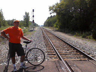
Second, we came across an actual railroad crossing on our Rail-To-Trail….a rail that has not been converted to a trail!!!   We stopped for a photo moment, and I hoped, in vain, for a train to come by, but it was fun anyway.  

RAIL TO TRAIL MEETS RAIL!
Soon after, we reached out 10 mile destination of the very small town Grand Station.  According to a Kal-Haven brochure, there was a restaurant in the town.   We got to the town, had to ride a short distance from the trail, and found the restaurant….10 minutes AFTER it closed.   Not to be deterred, I spotted a Marathon gas station just up the road.   I had a hankering for some ice cream, so we rode on up to the gas station/convenience store.


EATING AN ICE CREAM NOVELTY
 IS A BIKE TRAIL NOVELTY!!
WELL, riding up to it, and after going inside, we decided it was in our best interest to make a QUICK selection and get out of there.  Let’s just say that we were aware that southern MI is (reportedly) home to several ultra-conservative militia groups…we may have spotted a few of their members!   We stuffed the ice cream novelties into my bike pack and drove back to a shaded area on the trail.   Judging from the surprised expressions on bikers that passed us, people eating ice cream on a bike path.   We answered people’s questions as to where we conjured up some ice cream (“just up the path on the left at the gas station”) and let them have their own experiences!


CELEBRATION!!!
It was time to head back, and it was then that we hit the milestone of 400 miles traveled on my pedometer.  Of course, it was a photo moment and time to celebrate (and rest).

We finally made it back and, as I remembered, the last part of the path was uphill.   We did stop for a break before the big incline to enjoy the bridge over the Black River and ride down a wooden boardwalk to the river so the final push wasn’t too bad. 


VIEW FROM BRIDGE OVER BLACK RIVER
 
 As I again discovered, the last 3 miles of this 20 mile ride were the worst (I was ready to be off my bike, and my feet always seem to hurt at the end).  We did notice that there is a shuttle service that serves the Kal-Haven path, allowing a person to have to ride only one way, get further, and avoid the return trip mileage.  Sounds like a plan to me next time!

The stats: 20.18(RT), Time 2:18:48  , ODO:  407.48
FIND THE TURTLES . . .
. . . HERE THEY ARE

Notable Nature Sightings:  Lots of turtles on a log are not really notable, but we did cross a real RR crossing and use a water pump


Sunday, August 12, 2012

There and Back...all before 10 AM!

August 12, 2012  PEDALS adventure: 

It’s always fun to introduce novice “urban bikers” to the ins and outs of riding the trails. Our neighbors, Alex and Jennifer, have enjoyed the holiday donut rides with us from our homes, and Jennifer has even ridden with me in the annual nighttime FW Rivergreenway ride sponsored by the FW Parks Department.  Alex, however, has yet to start an urban ride from anywhere other than his own driveway.  After this ride, we have changed all of that!

Our favorite FW Rivergreenway path is the Maumee Path.   It is on the east side of FW, travels along the Maumee River, eventually ending in downtown.   More often than not, rides on this path end at what we consider to be the coolest Starbucks anywhere at the corner of Jefferson and Fairfield streets. The four of us decided this would be a great morning ride destination and set off from our house at 7 AM.  

It was a beautiful morning, although a bit cool for August.  We layered up, as much of the path by the river is heavily wooded and could be cooler than at our houses.   We drove to the Carrington Field trailhead on Coliseum Blvd. to start the ride. We enjoyed the shadows that the early morning sun cast on the path and the River, traveled alongside some FW neighborhoods, and soon found ourselves riding on the bike lanes in downtown FW.
Our favorite Starbucks
Jefferson and Fairfield in Fort Wayne

The downtown FW Starbucks is located in a renovated old Firestone Tire store.  The store was about to be demolished when SB purchased it, and turned it into a funky coffee spot.  Besides the typical ordering and seating area inside, this SB has an outdoor ”garage” area, with tables, chairs, couches and giant overhead garage doors that are opened (or closed) as the weather warrants, as well as a fabulous outdoor patio area.  
 
We got our drinks and pastries and sat under the old photos of the Firestone as it used to be.  Besides enjoying good coffee and great conversation,  we enjoyed looking at the ridiculously low price for tires that was advertised in the old photo taken when it was a Firestone store.  The architecture of the old store certainly stands out, and I, for one, am grateful that SB rescued it from the wrecking ball, and maintained the façade, making it both vintage and modern all at once.  It is no wonder it is our favorite SB location ANYWHERE, whether you sit on the patio watching the wide variety of  cars go by on the major downtown thoroughfare (Tom says it’s a great place to “shop” for a new vehicle..if you wait long enough, every kind eventually goes by),  or choose the garage, or even stay in the store (when it’s too cold). 

The coolest thing about Alex’s bike is that is has a nifty pressure spring shelf on the back, an accessory to go along with its designation as a “commuter bike.”   While we have never figured out how anything very big would fit under the pressure spring arm, I was able to utilize it on my first ever biking/shopping experience.   This SB had Café Verona K-cups for use in our Keurig coffeemaker at home….it was the first time I had seen that blend in a K-cup.   I whipped out my gold SB gift card, bought a box, and loaded it on the back of Alex’s bike.   AWESOME!!!  

The only thing left to do was to hop back on our bikes and back to our car and back to our neighborhood….an adventure in biking and eating and friendship, all before 10 AM!
The stats: 8.2  (RT), Time: 59 min. , ODO: 387 miles

Saturday, August 11, 2012

VISITING THE WORLD FROM A BIKE SEAT!

August 11, 2012  PEDALS adventure: 

There is a theme of Celebration Rides this summer, i.e. celebrate something “older” with something new!  In honor of our 33rd wedding anniversary, we decided to investigate a trail on our “to-ride” list, The Nickel Plate trail in Indiana.

The Nickel Plate is a long trail (by Indiana standards) with two distinct legs, Peru to Cassville and Peru to Rochester.  We decided to try the southern leg, Peru to Cassville and save the other for another day.   In reality, we only did 6 miles of the trail to Bunker Hill before we turned around---the round trip mileage of an “11 mile” ride is more than I care to do.   I’m not yet prepared to spend an entire day on my bike seat!


The best trailhead for parking for the southern leg is just  south of the Wabash River in Peru, so we went north for a short distance when we hopped on our bikes.   The Nickel Plate Trail bridge over the Wabash River is great and it was nice to be able to stop and look at the river without worrying about on-coming cars.  Considering the recent rains that had fallen, the Wabash was not particularly high, a consequence of the rain being absorbed by the drought-stricken fields.  We soon turned south and experienced an unusual rail-to-trail phenomenon…..and long-term incline. 
WABASH RIVER FROM NICKEL PLATE
BRIDGE IN PERU


We (or at least I) like Rails-to-Trails because rail beds were created to have very little ”grade” (or at least very gradual) to conserve the energy it would take the engine to pull the train.  This translates into very flat trails for us (me) to ride.  The Nickel Plate trail had a distinct long-term grade, a consequence of moving away from the Wabash River Valley (according to Tom).  It was not a super hard ride, but it lasted long enough for me to look forward to the promise of a downhill return ride.

The path is very heavily wooded and shaded at the beginning.  The remnants of a dam (as was described on Rails-to-Trails.com) complete with flower bed was easily spotted. Our goal was Pipe Creek, near Bunker Hill, IN.  Eventually, the gead leveled out as  we exited the wooded area and entered farmland.  Still, the scenery was nice, and there was a nice bench for resting around mile 5.25.  We reached Pipe Creek bridge and were met with a VERY HIGH BRIDGE over a very low creek.  We turned around soon found ourselves back at the car….after shaving 15 minutes off of our ride time due to our increased speed from the return trip being downhill!
VIEW DOWN THE NICKEL PLATE TRAIL


After a great anniversary meal at the BK Root Beer stand (complete with frosted mugs), we scouted out (by car) the northern leg of the Nickel Plate from Peru to Rochester.   We crossed the path several times at Denver (yet another Indiana town named for another city in the country/world) and definitely want to try that leg on another day.   Pairing it with a boat trip on the historic Wabash Canal in nearby Delphi sounds like a plan to us!!!!!

So in summary, we traveled the world (at least the western hemisphere) for our anniversary, visiting Peru, Bunker Hill, and Denver, all by way of Rochester and Mexico…and all without leaving our state…..ain’t Indiana great?

The stats: 12 miles (RT ), Time:  1 hour 5 min – 40 minutes out, 25 minutes back , ODO: 379

Notable Nature Sightings:  none

Wednesday, August 1, 2012

3 + 2 = 4. . . . NO, REALLY....IT DOES!

July  31-Aug 3, 2012  PEDALS AND PADDLES adventures: 

When does 3 + 2 = 4?  ANSWER: when you have 3 days in Michigan (land of many lakes and bike trails) and 2 different  modes of transportation strapped to your vehicle.  With a little bit of planning, and good luck with the weather, we completed 4 PEDALS and PADDLES adventures in the Whitehall, Michigan area.

We stayed at the Michillinda Lodge, which is situated ON THE BLUFF of Lake Michigan, approximately 20 miles north of Muskegon. 
MICHILLINDA LODGE
This lodge, originally constructed in the 1930s, is a mix of old world charm and old world amenities (like natural air conditioning, also known as open windows and a fan!)  With the screened porch of our room literally overlooking Lake Michigan, LOCATION makes this place awesome, and listening to the waves each night is a pleasure that A/C can never give you.  KUDOS to Tom for finding such a fabulous base for our adventures.


THE WHITE RIVER
DAY ONE - ADVENTURE 1: Our first adventure was a PADDLE down the White River, which we did immediately upon arriving in West Central Michigan.    We checked in at the Happy Mohawk Canoe Livery, outside of Montague, where we put in the White River for a 3 hour tour.  Unlike Gilligan and friends, this 3 hour tour took just that long, with a rep. from Happy Mohawk meeting us at the appointed pickup place, where he transported our kayaks back to our Highlander. 


CAN YOU FIND THE TURTLE ON THE LOG?
The White River benefited from recent rains, but still remained a relatively shallow and calm river, with a gentle flowing current.  However, what it lacks in current speed, it more than makes up in “S” curves, snaking back and forth giving us a chance to practice our steering skills.  We were the only ones on that part of the river, so it was a quiet ride.  Water animals and birds seemed to also be absent, but it was a delightfully peaceful adventure.  Dinner at Michillinda Lodge overlooking Lake Michigan ended Day 1.


WHAT WORD IS MISSPELLED ON THIS SIGN?
DAY TWO -  ADVENTURES 2 & 3: The plan for Day 2 was a ride on the Hart-Montague Trail, which began in the small town of Montague.  This trail was one of the first linear State Parks in Michigan when it was first transformed from a “rail” to a “trail.”  In total, the path is 22 miles long, connecting the towns of Hart and Montague, although our goal was 11 miles north, near the town of Shelby.  We chose this spot because the Country Dairy Farm is located right on the trail, where one can take a tour of their dairy operations, and visit their restaurant.  Of course, that interested me, with my motto “I Bike to Eat.” 

In true Rail-to Trail form, the path is straight and almost totally flat.  It quickly leaves the small-town buildings of Montague and opens to a more rural setting.  While not as shaded as some paths we have ridden, it is tree lined and picturesque.  With the exception of some cardinals, wildlife is not prevalent on this path.  However, some notable signage on the path kept us entertained as we peddled. 

IT GOES WITHOUT SAYING,
 RIGHT? SO....
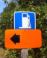
First, we were not surprised to see the “No Motorized Vehicles” signs at several crossroads.  What caught our attention was several gas pump signs, indicated we could get gas (and other amenities I’m sure) just a short distance from the path.   A GAS PUMP sign….seriously?  I laughed at the incongruity of it!

....WHY DO WE NEED A GAS
PUMP SIGN ON THE PATH??
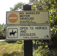
The second “only in Michigan” sign happened when we noticed a grassy path running parallel to our paved bike path.   We recognized it as a horse trail, not uncommon along Indiana trails.  What did catch my attention was the sign labeling this path as a Horse AND SNOWMOBILE path….NICE!!!!  This area would be fabulous in winter with Lake effect snows covering the ground.  Hmmm, maybe we will have to consider this for one of our snow-shoeing PEDS adventures in the winter.


NOT GOING TO SEE THIS
ON AN INDIANA SIGN!


After a delicious ice cream cone at the Country Dairy Farm (made, of course from their own milk), it was back the 11 miles to Montague. 
ME @ THE COUNTRY
DAIRY STORE
VISTA LEAVING THE
COUNTRY DAIRY STORE
Right around the 18th mile, I could tell we were pushing this adventure into new territory, and I wasn’t sure I was too happy about it.  This was turning out to be our LONGEST pedal we have ever completed, and the last 2 miles were the longest.   I really need to get some more people who are willing to “spot us” by meeting us at a designated destination, eliminating the need for us to re-cover ground we have already covered just to get back to our vehicle. 
BIRCH TREES WERE
PREVELANT.


TOM BELOW THE
WEATHERVANE
Upon returning to Montague, we visited the World’s Largest Weather Vane, constructed in honor of a 19th century shipwreck and the shipping history of the area.   The final tally was 23 miles….time to rest at the Lodge.


The stats: 23.04 (RT ), Time 2:21 , ODO: 367.55


CHANNEL CONNECTING
WHITE LAKE AND LAKE MICHIGAN
Of course, a bike ride is primarily a lower body workout, so Tom decided that a sunset paddle on Lake Michigan would be in order.  We had scouted out the area and discovered a narrow public access site located near the channel that connected White Lake and Lake Michigan.   We launched, went through the channel and then over to the northern side of the breakwater, where the waves were somewhat less. 
 
We beached our kayaks and enjoyed some time just sitting on the beach watching the sun and waves. 

Because of the waves, we couldn’t launch directly from  the beach, instead we had to walk it out in the shallow waters where there were some breaks between the waves.  True confession:  I tipped the kayak while getting in, rewarding me with a dunk into Lake Michigan….nothing was in danger except my dignity.  Tom was busy with his own maneuvers so he missed my baptism.  

SUE KAYAKING AFTER
THE MOONRISE
As it turned out, the sunset was less than spectacular, BUT the moonrise over the lighthouse and White Lake was worth the trip.   We were rewarded for our efforts with needing to dump the water out of the kayaks and reloading them in the ever- deepening dusk.  Glad we don’t have to do those things often.


THE GRAND RIVER


DAY THREE - ADVENTURE 4: Being in the throes of the Drought of 2012, it was hard to begrudge the rain that came off of Lake Michigan over night and in the morning.  In fact, sitting in our screened porch, watching the rain approach across the lake, gave us a chance to plan our final adventure, a kayak trip, to take place en route to Ft. Wayne.   Our destination was Crockery Creek, a tributary of the Grand River between Grand Rapids and Grand Haven. 

Through a lot of Google Mapping and Google Earth, we found a public access site across the river from the mouth of Crockery Creek.  It was a good of a spot as it appeared on the map, but the paddle across the Grand River was a bit further than it seemed from the shore.  

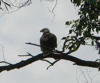
While Tom was fiddling with the car after unloading, I began watching a very large bird with what appeared to be an extremely large wing span circling over the river.   Remembering what Tom has told me about the extraordinary size of bald eagles in relation to other birds, I was intrigued.  I told him about it as we got in our kayaks and made our way over to Crockery Creek. 

EAGLE WATCHING THE RIVER
Sure enough, just after we entered the creek and paddled around a bend, the very large bird flew overhead to a tree just up ahead.  I thought I saw a flash of white and I quietly paddled upstream to find the perch of the alleged bald eagle, while Tom quietly slipped out the camera.  I pointed to the top of a dead tree where I spied the bird quietly sitting.  

 He got a few pictures, still not convinced it was an eagle.   Meanwhile, 2 small boys came paddling around the bend from upstream and I motioned for them to be quiet and look up in the direction of the eagle.   As their mom paddled into view, we all watched the eagle as the eagle, in turn, watched the river.  
CLOSEUP OF BALD EAGLE ON CROCKERY CREEK
 After the eagle flew away, she confirmed that the Grand River is the home to several bald eagles, including a juvenile which was the largest one she has ever seen.  As recently as the day before, she watched the eagles share a giant carp, one of her pleasures for being a river resident. 

As we quietly thanked her for the information and paddled our separate ways,  Tom encouraged me to look ahead around the bends in the creek, as eagles are prone to perch at the top of dead trees just out of our range of eyesight.   Just then, as if he heard Tom, another eagle suddenly flew off from a tree just ahead of us, with his white tale flashing in within the trees.   He was too fast for Tom to get a picture, and despite spending the rest of the trip barely paddling and barely talking, we never again saw another eagle.   Soon, we gave, turning around and paddled against  a headwind across the Grand River and back towards home.

PEACEFUL CROCKERY CREEK
Three days, four adventures, and lots of time to gaze across Lake Michigan the top of the bluff at Michillinda Lodge.  We had a great time, and have decided the area, with more places to paddle and more Rails-to-Trails to ride, deserves a place in our future plans.   See you later, West Central Michigan.

Notable Nature Sighting:  Two sightings of bald eagles…very cool!


PS:  THE MISSPELLED WORD ON THE SIGN IS "SUNDAY"  ...SHOULD BE "SUNDAE"